By Blake Actkinson
Graduate Student, Department of Civil and Environmental Engineering, Rice University
Air pollution exposure is a pressing health problem for Houstonians. In the 2020 Harris Cares report, the Harris County Health Department found “much of Eastern Harris County falls within the top 95-100% highest risk category for cancer in the state” from air pollution. The aftermath of Hurricane Harvey brought with it numerous chemical releases, with reports of foul odors and high measurements of benzene, a potent carcinogen, in the southeast Houston neighborhood of Manchester. Last year, tanks of naphthalene at Intercontinental Terminal Co. went up in flames, shooting a jet black plume across the city. Even though the plume itself was determined not to pose a health risk, the Texas Commission on Environmental Quality’s monitor in Deer Park, another neighborhood in southeast Houston, measured concentrations of benzene higher than the agency’s short-term exposure guidelines in the days after the fire. This incident prompted the city to convene a task force to discuss ways in which they could improve emergency readiness. In the report, the city acknowledges the need for more air monitoring and the development of a “Community Monitoring Strategy.” To address this issue, the city should take this opportunity to outfit a fleet of vehicles with air pollution instruments that deliver geolocated measurements year-round as a part of its community monitoring strategy. Although these vehicles would not be focused solely on emergency response, they would measure air pollution in areas that cannot be covered effectively by the city’s existing monitors and would take additional measurements in areas surrounding emergency air pollution events.
Systematic mobile monitoring is a rapidly developing technology made possible through recent advances in data science and air quality. Instruments can be loaded onto a vehicle and take measurements via tubes sampling the air outside. These instruments record measurements that are plotted onto a map. After sampling a location multiple times and carefully controlling for the time and day, air pollution can be more clearly characterized in that location . Recent mobile monitoring work in Houston has demonstrated that after nine months of measurements, statistically elevated air pollution concentrations on roads throughout different neighborhoods can be observed.
Mobile monitoring measurements can complement the measurements made by the city’s stationary monitors and allow us to see and understand air pollution differences that would not be obvious with the city’s existing monitors. In Houston, research has found that air pollution in front of several metal recyclers is comparable to the air pollution at the nearest freeway. Concentrations of nitrogen dioxide were elevated across some neighborhoods within the Washington Corridor, an upper middle-class residential area northwest of downtown Houston, compared to others. These are differences that would not be apparent using the city’s monitoring network alone. These new insights allow the city to target sites more strategically for emissions reductions, leading to a better quality of life for Houstonians.
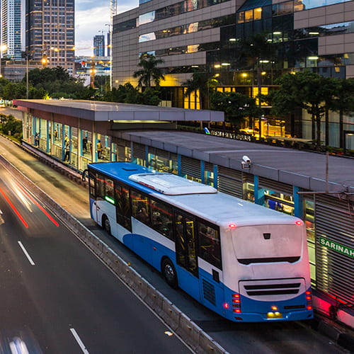
To minimize cost, the city could implement mobile monitoring by leveraging current infrastructure and building upon the pilot it conducted with the Environmental Defense Fund using municipal vehicles. Buses in Houston already drive prescribed routes daily. Putting monitors on buses that cover a wide variety of routes would provide the measurements needed to complement stationary monitors. The Houston MetroRAIL, though confined to a few routes, could also hold air quality instruments. Researchers in Salt Lake City outfitted a rail line to measure a wide variety of air pollutants to great success.
In the event of an emergency, the city’s mobile fleet could be used to target specific neighborhoods. The vehicles would patrol neighborhoods and take continuous measurements, decreasing the risk of adverse exposure and putting residents’ minds at ease. After the emergency passes, the mobile fleet would resume its normal sampling.
Systematic mobile monitoring has the potential to address not only problems in emergency air monitoring but also problems with the city’s existing stationary monitor network. The city’s officials should consider implementing it in the years to come to ensure a better quality of life for all Houstonians.
This blog post is part of the Baker Institute Science and Technology Policy Program’s Developing Civic Scientist Leaders project.